

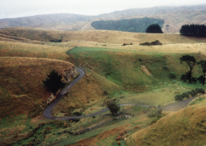
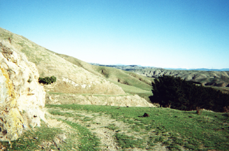
In 1841 a track used by local Maori was converted into a short, rudimentary road to cater for the new settlers in the Ohariu Valley. Improvements to what is now known as 'Old Coach Road' began in late 1856. Using a 'bench-cut' construction technique, workers created a flat ridge with a hard outside edge approximately 4.2 metres wide. In accordance with the normal building practices of the period, the road was built on a constant gradient of between 1 in 12 and 1 in 15. This was too steep for coaches but was sufficient to allow the bullock teams the road was for to travel along its length. The road was completed in 1859. In 1866 a road suitable for coach travel provide a second access route to the valley. This new road became the main route and in 1897 lower usage of the Old Coach Road prompted its closure. In 1945, and again in 1971, parts of the road were widened and sealed for use by new housing divisions on the Johnsonville end of the road. The rest of the road, now used primarily for recreational pursuits, remains one of New Zealand's best examples of an original nineteenth-century public works thoroughfare.
Location
List Entry Information
Overview
Detailed List Entry
Status
Listed
List Entry Status
Historic Place Category 1
Access
Able to Visit
List Number
7396
Date Entered
6th June 1997
Date of Effect
6th June 1997
City/District Council
Wellington City
Region
Wellington Region
Extent of List Entry
The Registration includes the unsealed section of Old Coach Road, which extends from the intersection between Old Coach Road and Rifle Range Road in Ohariu Valley, to the end of the unsealed intersection between the unsealed portion of Old Coach Road and Broderick Road in Johnsonville.
Legal description
Part of Road shown on SO 19727, SO 36894, 37205, Wellington Land District
Location Description
Unsealed road from Rifle Range Road in Ohariu Valley to Broderick Road, Johnsonville.
Stay up to date with Heritage this month
